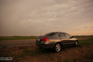
I departed ICT around 3:30pm after work and quickly outfitting my car with chase gear. Due to my late departure time, I chase to adjust my initial target area eastward from Pratt, KS to Kingman, KS. Unfortunately, my late departure prevented me from being able to join Project Hailstone for operations on this day. With meager low level shear, my main goals for the day were to get back into the groove of chasing before rejoining HailSTONE, shoot structure and observe hail.
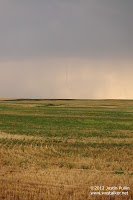
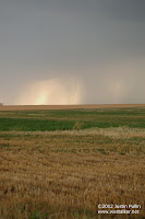
Storms initiated along the cold front across Central Kansas around 4pm, with the southernmost cell near Stafford, KS showing the most promise. Upon reaching Kingman, Kansas a little after 4:30pm, I decided to move north on State Highway 14 and northeast on back roads toward Hutchinson to get ahead of this particular storm. After spending an hour shooting structure and observing the updraft base of the storm that featured persistent rainfall in the vicinity, I noticed the storm begin to move to the southeast and backbuild toward cumulus towers that were going up to the south.
After finally briefly getting caught in hail, I quickly blasted southeast out of the path of the rapidly developing QLCS and shot some structure in the company of some storm chasers from Switzerland near Caldwell, Kansas. After observing some decent structure, several CG strikes, and a colorful sunset behind the newly formed QLCS, I wrapped up one of my most surprising and satisfying chases with a short drive back to ICT.
Distance: 200 miles
Wx: 3 tornadoes, large hail, structure


No comments:
Post a Comment