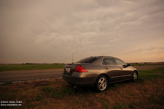
I departed ICT around 3:30pm after work and quickly outfitting my car with chase gear. Due to my late departure time, I chase to adjust my initial target area eastward from Pratt, KS to Kingman, KS. Unfortunately, my late departure prevented me from being able to join Project Hailstone for operations on this day. With meager low level shear, my main goals for the day were to get back into the groove of chasing before rejoining HailSTONE, shoot structure and observe hail.
Storms initiated along the cold front across Central Kansas around 4pm, with the southernmost cell near Stafford, KS showing the most promise. Upon reaching Kingman, Kansas a little after 4:30pm, I decided to move north on State Highway 14 and northeast on back roads toward Hutchinson to get ahead of this particular storm. After spending an hour shooting structure and observing the updraft base of the storm that featured persistent rainfall in the vicinity, I noticed the storm begin to move to the southeast and backbuild toward cumulus towers that were going up to the south.

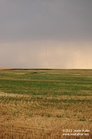
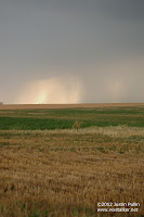
At this point, I decided it was in my best interest to proceed south on highway 17 toward Murdock, KS. Before I could do this, I met the entire ROTATE team waiting to turn onto the same road. After allowing the ROTATE team to go ahead of me, I was able to proceed south. After 5 miles of driving south, I spotted a thin funnel cloud through the persistent precipitation in the vicinity of the updraft. After quickly pulling over and grabbing my camera, I observed and documented two seperate rope landspouts that lasted a little less than a minute apeice.


After documenting these landspouts, I noticed storms were beginning to initiate and intensify to the south of my storm, thus introducing the chance for mergers to occur. I decided to quickly proceed south of Highway 400 toward Harper and Argonia, where I began to take back roads to better position myself to observe additional tornadoes. I coincidentally ran into Jared Leighton and Mike Mezuel from the HailSTONE team while repositioning to the south and observed my third tornado of the day near Rago, KS from a distance over the trees that landscaped the area. Upon my initial analysis of radar data, it appears that these tornadoes formed as the result of a storm merger, thus marking the first time that I've observed such an event from start to finish in the field (12/31/10 in Jackson, MS was also a merger, but rainwrapped).
After finally briefly getting caught in hail, I quickly blasted southeast out of the path of the rapidly developing QLCS and shot some structure in the company of some storm chasers from Switzerland near Caldwell, Kansas. After observing some decent structure, several CG strikes, and a colorful sunset behind the newly formed QLCS, I wrapped up one of my most surprising and satisfying chases with a short drive back to ICT.
Distance: 200 miles
Wx: 3 tornadoes, large hail, structure


