Upon completing another work week, the pattern remained active for severe storms across the Southern and Central Plains with much of Oklahoma being under the threat for hail and high winds. Taking this into account, I decided to team up with a few of my new coworkers for a fairly short chase into northwestern Oklahoma.
Collectively, Crouch, Danna, Elliot, and I decided upon an initial target area of Alva, OK, setting a time frame for initiation between 4 and 5 pm. Unlike May 25, the chance for tornadoes were slim at best, with mesoscale influences being necessary for tornadogenesis to take place in any storm in this particular environment. However, the setup favored large to giant hail, as all soundings around our target area (LMN, OUN) featured one or more significant dry layers, thus steepening lapse rates considerably. Taking all of this into account, we loaded up and departed from ICT shortly after 2:30 pm and moved southwest toward our target area.
 |
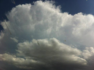
| Initial convection over our target area of Alva, OK. Photo courtesy of Becky Elliott. |
As we made the drive across far south-central Kansas, we observed a deepening cu field to our south trying to break through the cap in the vicinity of our initial target area of Alva, OK. Finally with the help of a residual outflow boundry from the previous day's convection, this updraft was able to overcome the cap. and we had our first storm of the day over Alva, OK as we quickly approached the Oklahoma border.
 |
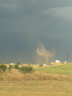
| Fairly large dust devil on the backside of our storm as we drove into Alva, OK. Photo courtesy of Becky Elliott. |
As we drove around the backside of our storm, we were greeted by extremely gusty outflow winds that generated a few short lived, yet large dustdevils. Once we arrived in Alva, we decided to blast east on Highway 64 to get a clean visual of the storm on the southside. We observed an extremely high based wall cloud that showed no threat of producing a tornado, as well as the hailcore of the storm. Along the way, we noticed that the particular storm we were on was flanking another storm that rapidly developed to it's northeast. Although not expecting tornadoes on this day, this presented the potential for these storms to merge, possibly allowing tornadogenesis to briefly occur in the northernmost storm. Taking this into account, we decided to continue to blast east as quickly as possible to get a visual on the northern cell.
Unfortunately, our plans were short lived as storms south of our location began to form and split. The right movers of the spilts that took place raced off to the north, with one particular right split blindsiding us from the south. Sporadic baseball sized hail greeted us and we quickly opted to turn around and escape before getting hit and potentially losing windows and the windshield. Having to reassess our strategy, we decided to move south on Highway 8 toward Fairview, Oklahoma in an effort to stay ahead of a well defined outflow boundary that was put off by the initial cells.
 |
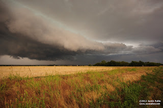
| Shelf cloud on the leading edge of our storm west of Ames, OK. |
Despite our efforts to stay ahead of the outflow boundary, convection going up south of our location continued to split and produce right moving hailers that cut off any eastward road options we had. Noticing a trend, we decided to drive back to the north toward Ames, OK, as a storm began going up slightly west of the initial line of cells that were moving southeast. This decision paid off, as we were able to observe a brief wall cloud before the storm gusted out and produced a well defined shelf cloud in its wake.
 |
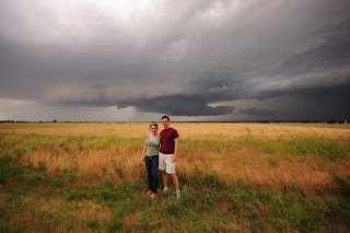
| Kate and Crouch take advantage of a photo op. |
 |
| Becky is thumbs up as she cures her "SDS". Photo courtesy of Becky Elliott |
After observing this, things began to get extremely messy once again, with storms going up everywhere and preventing us from getting a clean intercept. We drove south, then west toward the town of Okeene to catch back up to our storm. Here, we stopped at the edge of a neighborhood at a gas station to stage our next move. Here, the outflow boundary overtook us once again, producing some minor tree damage in the neighborhood. After observing more storms go up in a messy fashion along the outflow boundary, we decided to call it a chase. However, upon heading west back to our north/south option, Highway 8, we decided to head south into Watonga, OK to allow the storms to cross Highway 8 before heading back to ICT. Although things were far from ideal at times on this day, it turned out to be a decent chase at the end of the day. We arrived back in ICT shortly after midnight, where I began to prepare for a second straight day of chasing.
 |
| A weakening storm produces virga as the sun sets in the foreground. Photo courtesy of Becky Elliott. |
Distance: 508 miles
Wx: Baseball sized hail, structure.


